


















Norway's western fjord landscape holds some of the most dramatic hiking destinations in Europe. We've hiked all three of these trails ourselves, and each one delivers something unforgettable. These hikes are where we found our inspiration for Eunoia, and we hope they inspire you too. Ranked from the most accessible to the most demanding.
1. Preikestolen (Pulpit Rock)
- Location: Rogaland, near Stavanger
- Getting there: From Stavanger, drive or take the express bus to the trailhead at Preikestolen BaseCamp. The drive takes about 40 minutes via the Ryfast tunnel.
- Season: May–October (open year-round, but winter requires special equipment)
- Difficulty: Moderate
- Distance: ~8 km round trip
- Elevation gain: ~330–500 m
- Duration: 4–5 hours

Preikestolen is Norway's most visited cliff and an ideal starting point if you're new to Norwegian mountain hiking. The flat-topped plateau rises 604 metres straight above the Lysefjord, and when you arrive at the edge, the scale of the landscape genuinely takes your breath away.
You might recognise this cliff from the big screen, Preikestolen was used as a filming location for Mission: Impossible – Fallout (2018), where Tom Cruise hangs from its cliff face in the film's climactic final scene. The premiere was even held on top of the cliff itself, with 2,000 fans hiking up to watch the film projected at the summit.
The trail starts at Preikestolen Mountain Lodge near Lake Revsvatnet. It alternates between wooden walkways over marshland, steep stone staircases built by Nepalese Sherpas, and open rock terrain. The path is well-marked with red "T" markers, and navigation is straightforward. Expect some steep sections, but nothing technical.
Our tip:
Start early. By mid-morning in peak season, the trail gets crowded and parking fills up fast. A sunrise hike is magical, Preikestolen faces east, so you'll watch the morning light sweep across the fjord below.
2. Kjeragbolten
-
- Location: Rogaland, Lysefjord
- Getting there: The trailhead is at the Øygardstøl parking area. From Stavanger, the drive takes about 2.5 hours. In summer, a bus service operates from Stavanger to Lysebotn.
- Season: June 1–September 30 (road closed in winter)
- Difficulty: Challenging
- Distance: ~10–12 km round trip
- Elevation gain: ~570–800 m
- Duration: 6–8 hours

Kjeragbolten is the famous boulder wedged between two cliff walls, suspended nearly 1,000 metres above the Lysefjord. Standing on it is one of those rare experiences where a photo actually undersells the reality, the adrenaline is very real.
But Kjeragbolten is more than just the boulder. The hike itself is spectacular, crossing three steep ascents separated by two valleys. Each climb involves chain-assisted sections bolted into smooth granite, which can be slippery in wet weather. The pattern of steep up, valley crossing, steep up again is physically demanding and tests your mental stamina just as much as your legs. After the third climb, the terrain flattens out across a high plateau with increasingly dramatic views before you reach the boulder.
Our tip:
Do not attempt this hike in rain. Wet granite and the chain sections become genuinely dangerous. Check the weather forecast carefully and be willing to postpone. Also, bring proper hiking boots with good grip, trainers won't cut it here.
3. Trolltunga (The Troll's Tongue)
-
- Location: Hordaland, near Odda
- Getting there: The nearest town is Odda, in the Hardanger region. You can drive to the parking areas or take a shuttle from Odda up to Skjeggedal. Combine the trip with a visit to Rallarvegen and the Flåm Railway for an unforgettable Norwegian experience.
- Season: June 1–August 31 without a guide (guided hikes available October–May)
- Difficulty: Very demanding
- Distance: ~20–28 km round trip (depending on starting point)
- Elevation gain: ~800–1,100 m
- Duration: 8–12 hours

Trolltunga is the big one. The famous rock ledge juts horizontally out from the mountainside, 700 metres above Lake Ringedalsvatnet, and reaching it requires the kind of full-day commitment that you'll feel in your legs for days afterward. This is not a casual walk — it's a proper mountain expedition and arguably the most rewarding day hike in all of Norway.
From the upper parking lot at Mågelitopp (P3), the round trip is about 20 km with around 300 metres of elevation gain. From the lower starting point at Skjeggedal (P2), you're looking at 27–28 km with a steep initial climb known as "Himmelstigen" (the Stairway to Heaven). Most hikers take the P3 option, which requires prebooking and a shuttle in high season.
The terrain crosses wide, glacially carved plateaus, passes mountain tarns, and traverses rolling high country before arriving at the tongue itself. The trail is well-marked, and the path is solid underfoot, the challenge is the sheer distance and the accumulated elevation over the day.
Our tip:
Start before 8 am, bring more food and water than you think you need, and layer up. Weather at 1,180 metres can change dramatically, even in summer. Consider booking a guided hike if you have limited mountain experience, a local guide makes the trip safer and far more enriching.
Combine Your Trip
All three hikes can be done individually as day trips, but they also work beautifully as part of a longer road trip through western Norway. We especially recommend combining them with the Rallarvegen cycling route and the Flåm Railway, two experiences that showcase a completely different side of Norwegian nature.
Rallarvegen
Originally built as a supply road for the Bergen Railway, Rallarvegen is now one of Norway's most popular cycling routes. The 82 km stretch from Haugastøl to Flåm takes you across the Hardangervidda mountain plateau, past glacial waterfalls, snow-capped peaks, and down through lush green valleys. You can rent bikes at Haugastøl and drop them off in Flåm. It's a completely different way to experience the Norwegian landscape, less vertical than our three hikes, but just as breathtaking. Best from July to September when the road is snow-free.


Flåm Railway
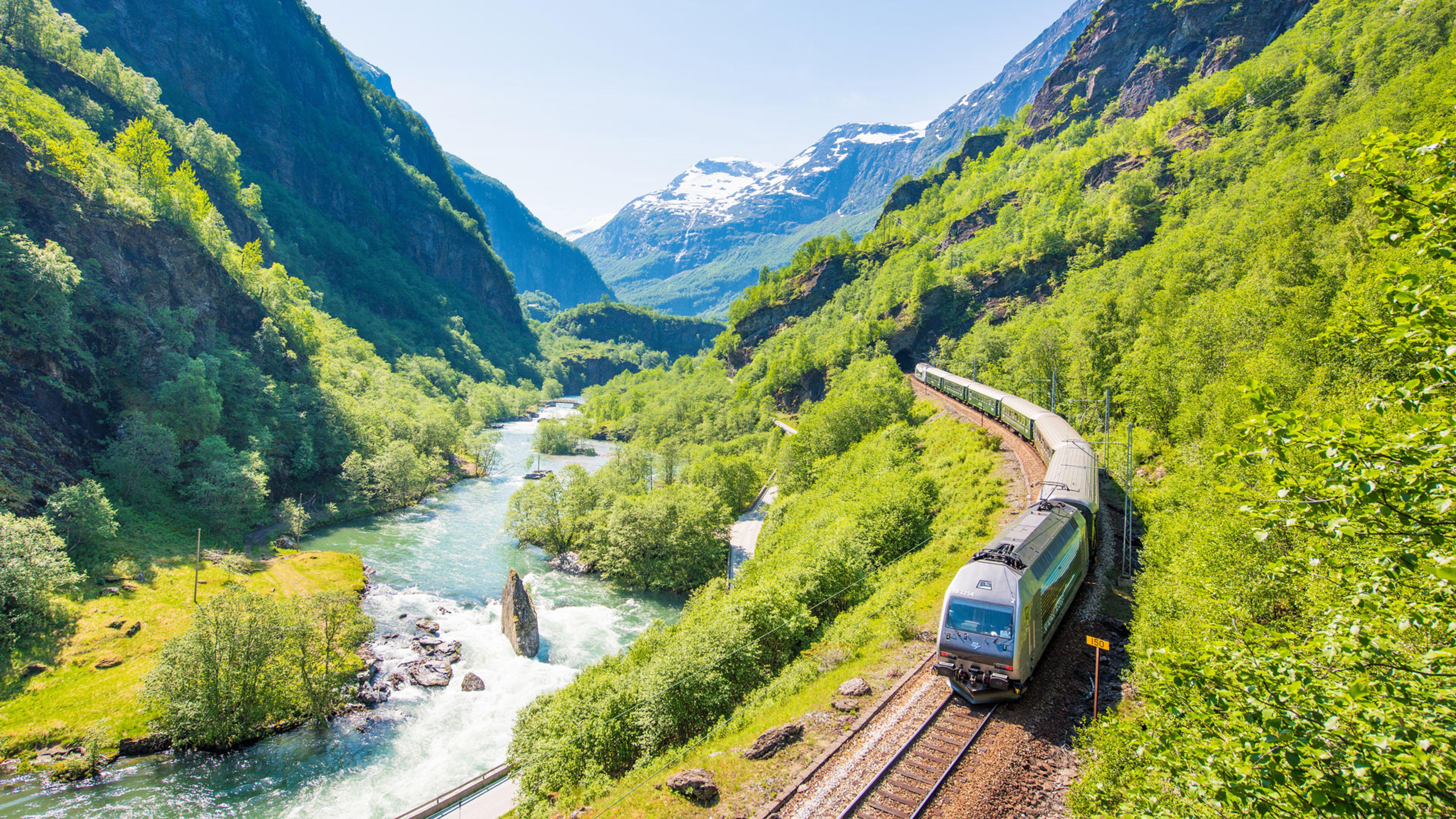
The Flåm Railway (Flåmsbana) is one of the steepest railway journeys in the world, dropping 866 metres over just 20 km from Myrdal station down to the village of Flåm by the Aurlandsfjord. The train passes through 20 tunnels and stops at the thundering Kjosfossen waterfall along the way. It's the perfect way to wind down after days of hiking, sit back and let the scenery come to you. Pairs naturally with Rallarvegen: cycle down, then take the train back up. You can order tickets for Flåm Railway here.


Last but not least,
Pack well, don't forget your EUNOIA cardigan. Start early. Respect the mountain.
Best,
Team EUNOIA


